Slackwater vs OceanConnect
Short version. OceanConnect is a forecast. It maps modelled currents over the whole coast for the next 48 hours, with wind, waves and water temperature on the same map. It shows what happens between stations, and a model can respond to wind and river flow, which a tide table cannot. Slackwater predicts slack and max flood and ebb at current stations, for any date, on the phone. Both are free with no account.
They answer different questions, and on the BC coast plenty of people will want both.
Slackwater features checked October 9, 2026; OceanConnect's details checked against its website, data sources page and App Store listing on October 17, 2026.
At a glance
| OceanConnect | Slackwater | |
|---|---|---|
| What it is | Ocean and weather forecast map | Tide and current station predictions |
| Price | Free, no login | Free core; optional Premium |
| Currents | Modelled field over the water, plus DFO and NOAA current stations | Station predictions: slack time and duration, max flood/ebb with set, curve |
| How far ahead | 48 hours, updated every 6 hours | Any date |
| Weather | Wind, waves, air and sea temperature | None |
| Coverage | Southern Alaska to Northern California | Currents in the US and Canada; tides worldwide |
| Offline | No offline mode documented | Bundled predictions offline; Canadian setup, some passes online-only |
| Platforms | Web, iOS, Android | iPhone, iPad and Apple Watch |
| Data | Environment and Climate Change Canada's CIOPS ocean models, HRDPS wind, RDWPS waves | NOAA constituents, CHS; named per station |
| Run by | Hakai Institute | Open Waters |
Side by side
There is no OceanConnect screenshot here; open it beside this page and drag the time slider through tomorrow. Here is Slackwater at Deception Pass:
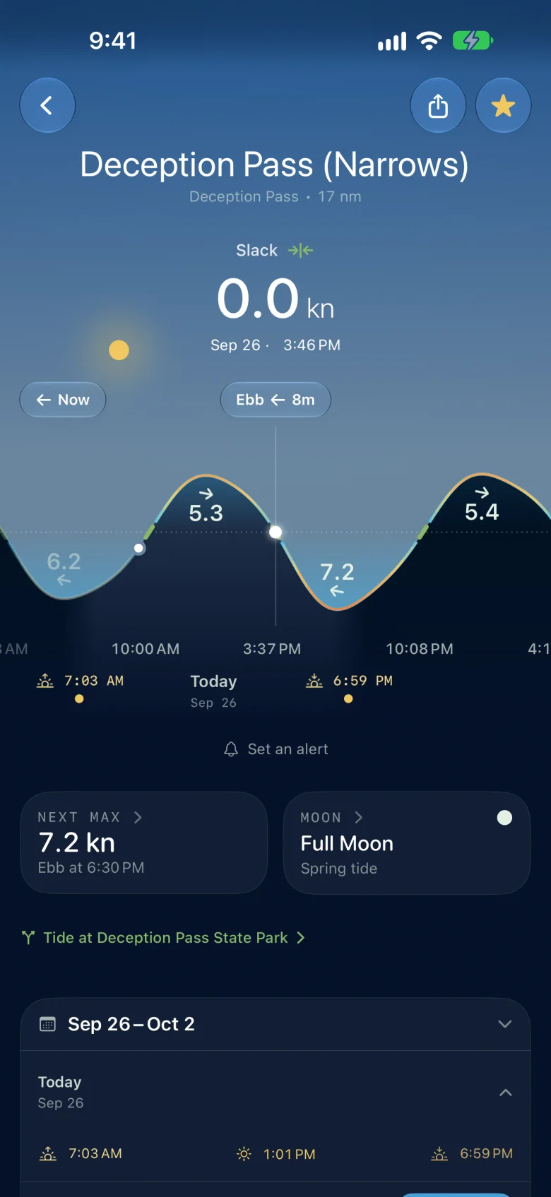
Deception Pass at slack: 0.0 knots, ebb in 8 minutes, with the next 7.2 knot maximum ebb at 6:30 PM. The green parts of the curve show the slack windows.
What each one answers
OceanConnect answers "what will the water be doing around me tomorrow afternoon?" Its currents come from forecast models run by Environment and Climate Change Canada with Fisheries and Oceans Canada: a 500-metre model of the Salish Sea and a 2-kilometre model of the wider coast, run four times a day. The map shows the eddies, the back channels and the flow off the end of a point. Being a forecast, it can include things a tide table leaves out. The Salish Sea model takes the Fraser's observed flow at Hope, and both are driven by forecast wind.
Slackwater answers "when can I get through this pass?" Pick the station and the readout is the state now, the next slack and how long it lasts, and max flood and ebb with speed and set, over a curve you scrub through the week. The reference port's tide is on the same screen. Predictions come from the published harmonics of NOAA and the Canadian Hydrographic Service.
In the narrows
The finer of the two models has 500-metre cells, and many BC passes are narrower than that. OceanConnect's developer says so plainly. Asked by BC Marine Trails in January 2026 about its limits, Nate Rosenstock said: "Currents (Wind, too) in small channels will often be wrong. I find in these spots it often gets the timing right but not the speed. Use the current stations when they are near, these are more accurate." (BC Marine Trails)
Station predictions have the opposite gap. They know nothing about weather. After a strong blow, or with a big river running, the real current will differ from the tables. OceanConnect can show that; Slackwater cannot.
Offline and how far ahead
OceanConnect needs a connection and documents no offline mode. Its forecast runs 48 hours ahead. Slackwater computes bundled predictions on the phone for any date. Most Canadian stations build an offline model after a download; some Canadian passes require a connection and are labeled in the app.
What OceanConnect has that Slackwater does not
The flow field between stations, wind, waves, sea and air temperature, nautical charts, buoys, weather stations and webcams, on the web and on Android as well as iPhone. Slackwater is a station app and does not draw a flow field or show weather.
Who should pick which
OceanConnect the night before, to see the wind and how the water is moving across the route.
Slackwater to pick the time to transit a pass, and to take with you past the end of the signal.
Both if you plan on OceanConnect and run on Slackwater.
Predictions are not observations. Weather, river flow and local conditions change the water. Neither one is for navigation; OceanConnect says the same of itself.
Download Slackwater on the App Store · Free, no account. Requires iOS 26 or later.
See also: the best tide and current apps for iPhone · Slackwater vs Actual Currents · Slackwater vs Dairiki.org